
Down to Earth in Lake Havasu: Arizona’s Playground
While 400 miles of stunning coastline form Arizona’s West Coast, 1,800 miles of trails are perfect territory for hiking, cycling and off-roading in Arizona’s Playground—from…
Cupcake Mountain Trail
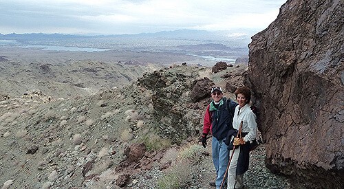
This signature hike offers spectacular views from atop an iconic mountain that provides Lake Havasu's most famous natural photographic backdrop. The trail is for experienced hikers only! Groups of 10 or more require a permit from the Bureau of Land Management.
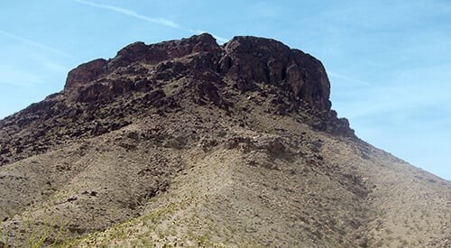
Cupcake Mountain was named by the Army Corps of Engineers in the early 1940s while building an airport runway on the Island. A light dusting of snow gave the appearance of frosting on top of the mountain. The Cupcake Mountain Trail was established in 1986 by Tim O'Connor.
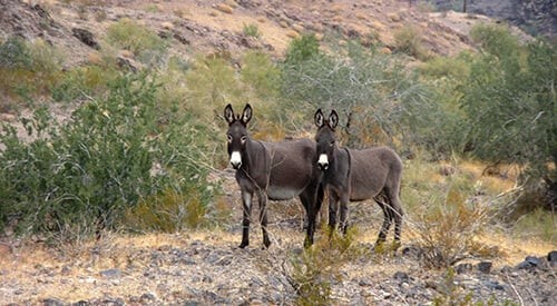
• Take Hwy 95 south from Lake Havasu City. Drive over Parker Dam to the Metropolitan Water District road. Head west on the road marked to Black Meadow Landing. Drive approximately 6 miles to a dirt road on the left heading towards Havasu Palms. • In 2 miles, the road to Havasu Palms veers right. Turn left on a private road following the main electrical towers for about another 6.5 miles. The road is occasionally maintained and may be rough. A 4-wheel drive high clearance vehicle is recommended. Use Caution!! • Look for the electrical tower on the right with a small straight road leading to it. It is situated just across from the end of the mountain block on the right, overlooking a clearing with a view of Lake Havasu City. Make sure it is tower # 50-G-1 or proceed to the next one. Park here. • Walk back about 50 yards on the road in the direction you came from. A rock cairn marks the start of the trail up Cupcake Mountain (elev 2878 ft), which is not in view until you hike around the first mountain called Indian Nose at approximately the halfway point.
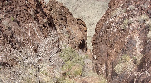
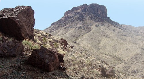
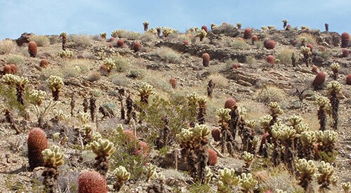
• Start up the trail and walk uphill for about 1.4 miles to a flat area in the shade on the north side of a mountain (elev 2060 ft). Cupcake Mountain now comes into view. • The trail curves left through a scenic cactus field and up to another flat area (elev 2310 ft) called the Pink Spot. From here to the top is all uphill, loose rock, and steep. (See level of difficulty above!) • The trail is not well defined. Follow rock cairns. The last section involves a short descent into a slot, crossing a short ledge, and a steep climb to the summit. Do not exceed your capabilities! Remember, you have to come back down the same way! • Commercial operators are not allowed on Cupcake Mountain.
Down to Earth in Lake Havasu: Arizona’s Playground
While 400 miles of stunning coastline form Arizona’s West Coast, 1,800 miles of trails are perfect territory for hiking, cycling and off-roading in Arizona’s Playground—from…
The Best of Fun in Lake Havasu City, AZ
Attention outdoor enthusiasts, adrenaline junkies and avid adventurers: you’re searching for hardcore fun in a perfect outdoor playground, right?
This website uses cookies to enhance your website experience. Learn More
Events
Lake Havasu City hosts exciting, year-round events that embrace the region's sunny skies, scenic landscape and endless fun.
Itineraries
Lake Havasu City has a variety of tours that explore the town, lake, and desert. If you're short on time or just possess an independent…
Outdoor Adventures
Lake Havasu City is a true recreational oasis, offering year-round outdoor adventures for every kind of escape. Dive into boating, paddleboarding, and fishing on the…


